Difference between revisions of "Stranggore Maps"
Jump to navigation
Jump to search
(Replaced content with "Category:Scheduled for Deletion") |
(Made this back into a page instead of a redirect) |
||
| (One intermediate revision by the same user not shown) | |||
| Line 1: | Line 1: | ||
| − | [[Category: | + | == Regional Maps == |
| + | The [http://maps.google.com/maps/ms?ie=UTF8&hl=en&msa=0&msid=217614003703233420079.0004a2a73e1adae1fbd70&ll=51.611195,-1.230469&spn=4.694622,9.942627&z=7&dg=feature Google Map] shows the whole Tribunal. | ||
| + | |||
| + | The Stranggore Environs map shows a few miles' radius around the covenant: | ||
| + | |||
| + | [[File:Stranggore_Environs.png|200px]] | ||
| + | |||
| + | == Covenant Maps and Floorplans == | ||
| + | Exterior View: | ||
| + | |||
| + | [[File:Stranggore_Exterior.png|200px]] | ||
| + | |||
| + | {| | ||
| + | |Ground Floor||Upper Floor||Towers||Basement | ||
| + | |- | ||
| + | |[[File:Covenant of Stranggore Floor 1.PNG|200px]]||[[File:Covenant of Stranggore Floor 2.PNG|200px]] | ||
| + | ||[[File:Covenant of Stranggore Floor 3.PNG|200px]]||[[File:Covenant of Stranggore Basement 1.PNG|200px]] | ||
| + | [[Category:Stranggore Maps]] | ||
| + | [[Category:Stranggore Covenant]] | ||
Latest revision as of 08:25, 6 April 2014
Regional Maps
The Google Map shows the whole Tribunal.
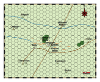
The Stranggore Environs map shows a few miles' radius around the covenant:
Covenant Maps and Floorplans
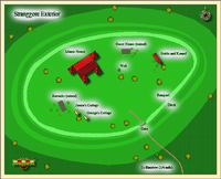
Exterior View:
| Ground Floor | Upper Floor | Towers | Basement |
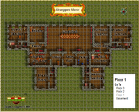 |
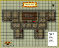
|
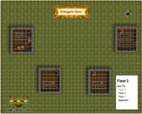 |
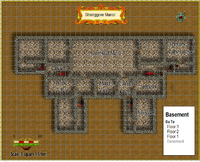
|
